#hurricaneseason
CSU forecasts below-average 2026 Atlantic hurricane season outlook
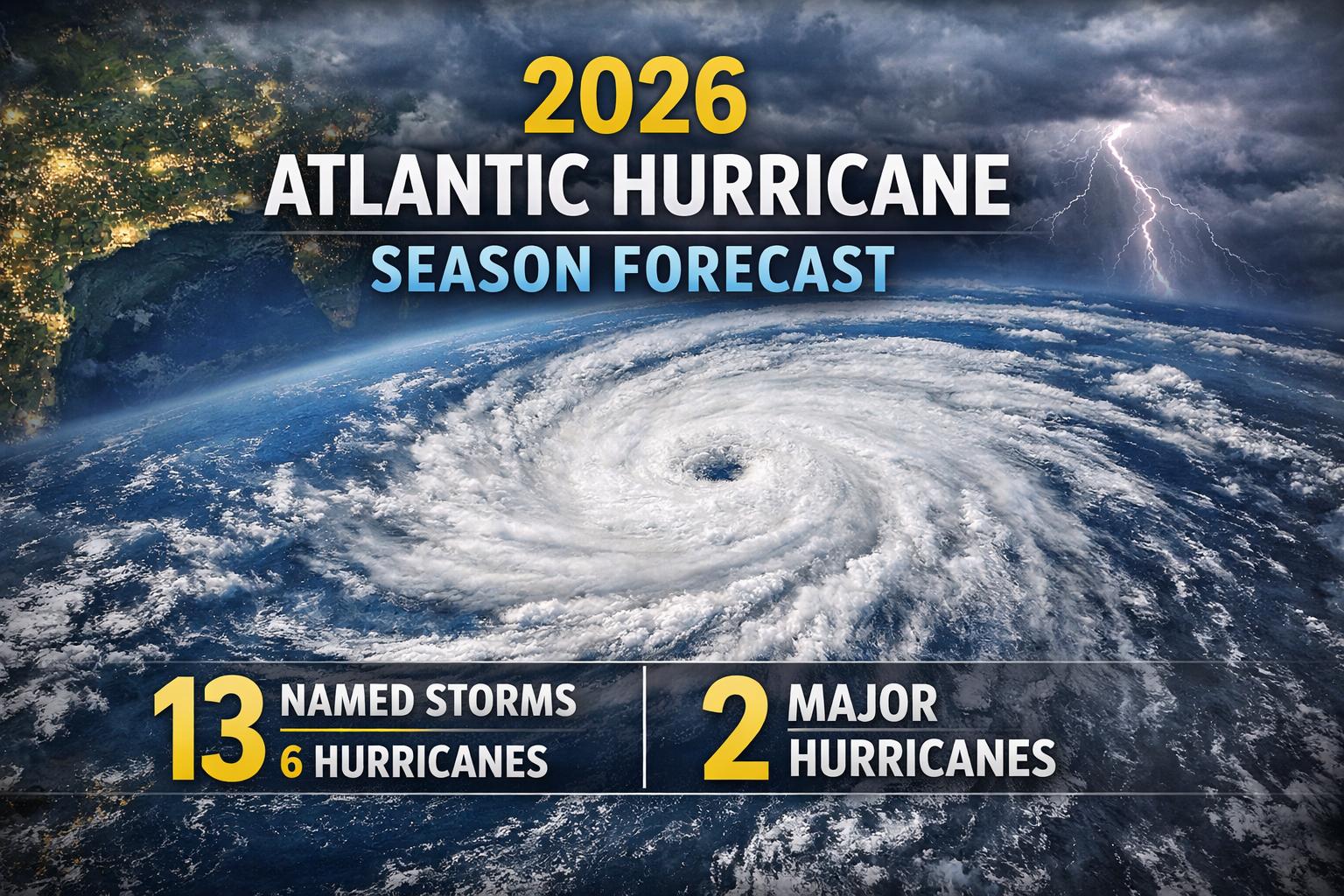
SOUTH PADRE ISLAND, Texas — Thursday, April 10, 2026 — Researchers at Colorado State University (CSU) released their first major outlook for the 2026 Atlantic hurricane season during the National Tropical Weather Conference held on South Padre Island, offering a cautiously optimistic forecast for the months ahead. According to CSU’s Department of Atmospheric Science, the upcoming season is expected to be slightly below average. The forecast projects 13 named storms, including six hurricanes and two major hurricanes classified as Category 3 or higher. By comparison, a typical Atlantic season produces approximately 14 named storms, seven hurricanes, and three major hurricanes. Forecasters attribute the subdued outlook largely to evolving global climate patterns. Current weak La Niña conditions are expected to transition into El Niño in the coming months, a shift that typically increases vertical wind shear across the tropical Atlantic. This atmospheric change can disrupt storm formation and limit the intensity of developing systems. In their analysis, CSU researchers emphasized that El Niño is likely to be the dominant influence during the peak of the season. Increased wind shear associated with this pattern generally reduces the likelihood of strong hurricanes forming and making landfall. As a result, the probability of major hurricane impacts along the continental United States coastline and across the Caribbean is expected to be lower than average. The report also highlights a reduced risk for the Gulf Coast region. CSU estimates a 20% chance of a hurricane making landfall between the Florida Panhandle and Brownsville, Texas, compared to the historical average of 27%. While this suggests a quieter season, researchers caution that even a below-average year can still produce significant and damaging storms. Phil Klotzbach, a senior research scientist at CSU and lead author of the forecast, noted that the projected 2026 season resembles patterns observed in past years such as 2006, 2009, 2015, and 2023. In those seasons, Texas experienced limited tropical activity, with no named storms in 2006 and 2009, and only minor systems recorded in 2015 and 2023. Despite the relatively lower forecast numbers, experts stress that preparedness remains critical, as hurricane activity can be unpredictable and even a single storm can have widespread impacts across coastal communities.
CSU forecasts below-average 2026 Atlantic hurricane season outlook
SOUTH PADRE ISLAND, Texas — Thursday, April 10, 2026 — Researchers at Colorado State University (CSU) released their first major outlook for the 2026 Atlantic hurricane season during the National Tropical Weather Conference held on South Padre Island, offering a cautiously optimistic forecast for the months ahead. According to CSU’s Department of Atmospheric Science, the upcoming season is expected to be slightly below average. The forecast projects 13 named storms, including six hurricanes and two major hurricanes classified as Category 3 or higher. By comparison, a typical Atlantic season produces approximately 14 named storms, seven hurricanes, and three major hurricanes. Forecasters attribute the subdued outlook largely to evolving global climate patterns. Current weak La Niña conditions are expected to transition into El Niño in the coming months, a shift that typically increases vertical wind shear across the tropical Atlantic. This atmospheric change can disrupt storm formation and limit the intensity of developing systems. In their analysis, CSU researchers emphasized that El Niño is likely to be the dominant influence during the peak of the season. Increased wind shear associated with this pattern generally reduces the likelihood of strong hurricanes forming and making landfall. As a result, the probability of major hurricane impacts along the continental United States coastline and across the Caribbean is expected to be lower than average. The report also highlights a reduced risk for the Gulf Coast region. CSU estimates a 20% chance of a hurricane making landfall between the Florida Panhandle and Brownsville, Texas, compared to the historical average of 27%. While this suggests a quieter season, researchers caution that even a below-average year can still produce significant and damaging storms. Phil Klotzbach, a senior research scientist at CSU and lead author of the forecast, noted that the projected 2026 season resembles patterns observed in past years such as 2006, 2009, 2015, and 2023. In those seasons, Texas experienced limited tropical activity, with no named storms in 2006 and 2009, and only minor systems recorded in 2015 and 2023. Despite the relatively lower forecast numbers, experts stress that preparedness remains critical, as hurricane activity can be unpredictable and even a single storm can have widespread impacts across coastal communities.
Hurricane Erin Causes Beach Closures and Rip Current Warnings Across US East Coast
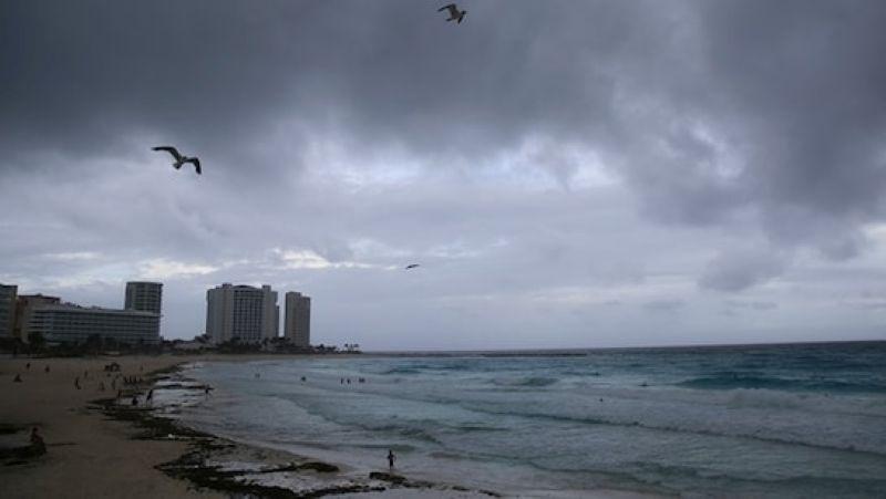
As Hurricane Erin makes its way up the East Coast, millions of people enjoying the last days of summer have been met with severe weather warnings and beach closures. From Florida to New England, coastal regions are bracing for dangerous rip currents, high surf, and strong winds. While the core of the storm is expected to remain far offshore, the outer edges of the hurricane are causing significant concern. On August
Hurricane Erin Causes Beach Closures and Rip Current Warnings Across US East Coast
As Hurricane Erin makes its way up the East Coast, millions of people enjoying the last days of summer have been met with severe weather warnings and beach closures. From Florida to New England, coastal regions are bracing for dangerous rip currents, high surf, and strong winds. While the core of the storm is expected to remain far offshore, the outer edges of the hurricane are causing significant concern. On August
Giant Saharan dust storm brings dry skies to Florida as hurricane season begins
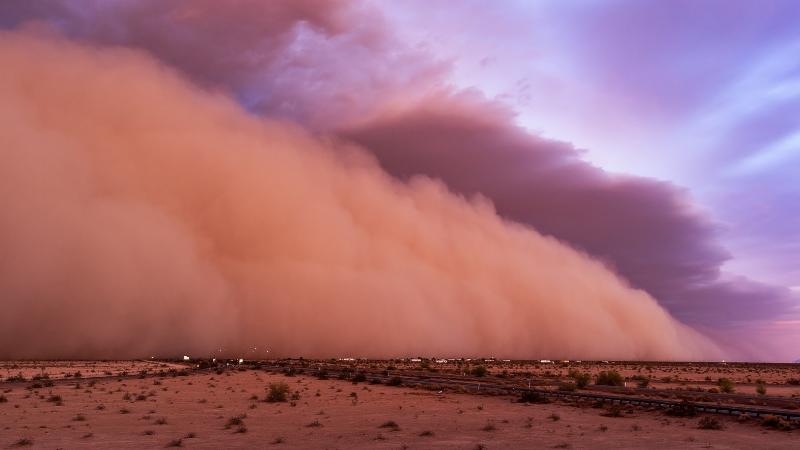
The 2025 Atlantic hurricane season has officially begun, but Florida has experienced an unusual stretch of dry weather as the state momentarily steps away from its typical early summer rain pattern. The primary cause of this unexpected dryness is a massive Saharan dust plume that drifted across the Atlantic Ocean and settled high above Florida last week. Traveling an astonishing 5,000 miles from Africa, the dust plume was large enough to be observed from space and has temporarily disrupted Fl
Giant Saharan dust storm brings dry skies to Florida as hurricane season begins
The 2025 Atlantic hurricane season has officially begun, but Florida has experienced an unusual stretch of dry weather as the state momentarily steps away from its typical early summer rain pattern. The primary cause of this unexpected dryness is a massive Saharan dust plume that drifted across the Atlantic Ocean and settled high above Florida last week. Traveling an astonishing 5,000 miles from Africa, the dust plume was large enough to be observed from space and has temporarily disrupted Fl