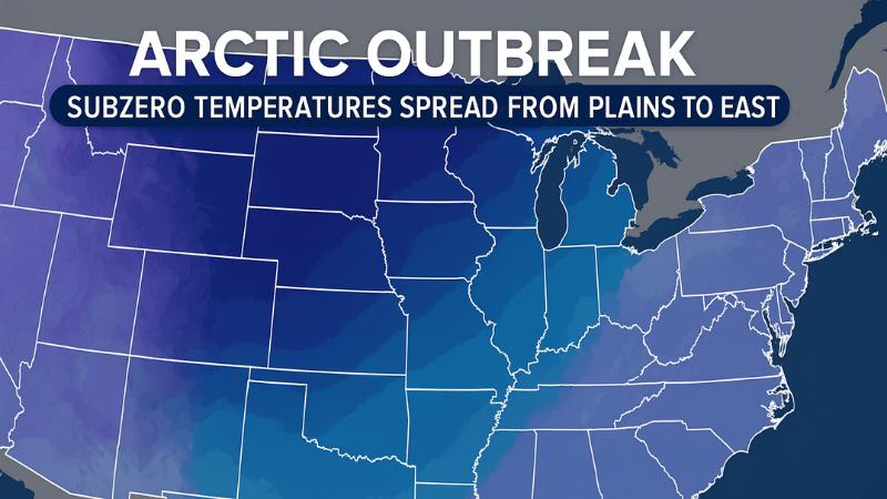
Monday is expected to bring the most severe temperatures of this initial wave, with subzero readings forecast across Montana, the Dakotas, Wyoming, Minnesota, and Wisconsin. In northern Montana, wind chills could reach 20 to 30 degrees below zero, prompting the issuance of cold weather advisories. Farther south, major cities including Chicago, Milwaukee, and Des Moines are expected to wake to single-digit temperatures, with little relief projected during the day. Forecasts indicate those areas may struggle to climb above zero throughout the week as the arctic air remains firmly entrenched.
The cold push is not confined to northern states. Meteorologists warn that the lower Mississippi River Valley may see temperatures drop low enough to trigger a minor ice event as the frigid air reaches deeper into the central United States. The spread of the cold coincides with ongoing winter storm activity, compounding travel challenges and hazardous conditions. One storm that disrupted travel over the Thanksgiving holiday dumped up to a foot of snow across parts of the Midwest, while another system, originating in Canada, moved into the Rockies on Sunday. The new storm is expected to generate additional snowfall as it interacts with the extremely cold air in place.
Forecasters note that the coldest conditions will persist across the High Plains and Upper Midwest through Tuesday and Wednesday, maintaining widespread below-freezing temperatures. By late week, another cold front will sweep across the country, reinforcing the arctic pattern and ushering in an even deeper surge of freezing air. This secondary push is likely to produce record-challenging lows on Thursday and Friday and expand the reach of the frigid temperatures from the Midwest to the densely populated I-95 corridor.
Cities including Pittsburgh, New York, Indianapolis, and Baltimore may see temperatures by Friday morning that resemble conditions more typical of early February than early December. Morning lows across the Midwest and Great Lakes are expected to fall into the single digits, while the Northeast may see temperatures in the upper teens to low 20s. Meteorologists say these developments align with earlier seasonal outlooks that anticipated a colder and snowier start to winter due to a weakening Polar Vortex and increasing influence from the La Niña climate pattern.
According to the latest guidance from the Climate Prediction Center, large portions of the country can expect the colder-than-average trend to continue through at least the first half of the month, along with a heightened likelihood of additional snowfall as winter weather systems continue to develop and interact with the entrenched arctic air.