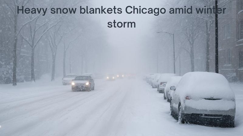
A powerful early-season winter storm brought heavy lake effect snow to parts of northeastern Illinois and northwest Indiana on Monday, causing significant travel disruptions, hazardous driving conditions, and widespread school closures. The unseasonal snowfall, which arrived in the middle of fall, blanketed some communities with more than a foot of snow while leaving others with little more than a dusting.
According to the National Weather Service (NWS), a winter storm warning remained in effect until 9 a.m. for Lake and Kankakee Counties in Illinois, as well as Porter and Northern LaPorte Counties in Indiana. Forecasters warned of “locally dangerous travel conditions” as strong lake effect snow bands moved through the region. Snowfall totals were expected to range between 4 and 8 inches east of Interstate 94, with localized areas receiving as much as 12 inches along the lakefront.
Additional winter weather advisories were issued until noon for DuPage, Cook, and Will Counties in Illinois, Kenosha County in Wisconsin, and Newton and Dubois Counties in Indiana. Those regions were forecast to receive another 1 to 2 inches of accumulation, with total snowfall reaching up to 4 inches. Meteorologists cautioned that visibility would remain low throughout the morning due to persistent snow showers.
Commuters faced treacherous conditions as the snow intensified during the morning rush hour. The NWS urged drivers to “plan on slippery road conditions” and warned that the hazardous weather could significantly impact travel times. By sunrise, multiple spin-outs and minor crashes had been reported throughout the Chicago metropolitan area, particularly in Lake County and along major highways.
A major multi-vehicle crash on DuSable Lake Shore Drive in Chicago’s Bronzeville neighborhood forced the closure of several northbound lanes early Monday. Emergency crews worked to clear the roadway as blowing snow and low visibility complicated recovery efforts. Despite road treatments and plowing operations, many streets remained snow-covered and slick as the storm persisted.
In Lake County, conditions deteriorated rapidly overnight. Reporters traveling along I-294 noted that the expressways were difficult to navigate, with snow obscuring lane markings and plows struggling to keep up. By 6 a.m., visibility had dropped to near zero in some northern suburbs as heavy snow continued to fall.
Meteorologists reported that the brunt of the storm was concentrated near the lakefront, where cold air moving over the warmer waters of Lake Michigan produced intense snow bands. “If you’re traveling this morning, it’s very treacherous, with low visibility,” one meteorologist warned. The snow was expected to taper off by the afternoon across northeastern Illinois, though conditions in northwest Indiana were likely to remain challenging well into the day.
By midmorning, isolated totals between six and twelve inches had been recorded in several areas. The heaviest snowfall was reported in Momence, Illinois, where an estimated foot of snow had already accumulated. In northwest Indiana, Lowell reported 10 inches, while Hobart saw 6.5 inches. Additional measurements included 3.5 inches in Chicago, 3.2 in Pleasant Prairie, 2.4 in Highland Park and Waukegan, and just under 3 inches in several southern suburbs such as Tinley Park and Park Forest.
The NWS reiterated that gusty winds and lingering snow bands could continue to affect visibility through late morning. “Travel is not advised where lake effect snow is occurring,” the agency said, adding that conditions would gradually improve from north to south as the storm system weakened.
The winter blast also forced dozens of schools across Illinois and Indiana to close or transition to remote learning. Districts from the Chicago suburbs to northwest Indiana cited safety concerns and poor road conditions as reasons for cancellations. Transportation officials urged residents to limit travel until plows could fully clear major routes and secondary roads.
As the morning progressed, forecasters expected snow showers to diminish and temperatures to slowly rise, offering a brief respite from the early taste of winter. However, with several inches already on the ground and icy conditions lingering, commuters and residents alike were reminded that the Midwest’s unpredictable weather season had only just begun.