A powerful and fast-moving storm system is forecast to sweep across the Northeast on Thursday, bringing heavy rain, gusty winds, and the potential for flash flooding that could disrupt commutes and Halloween celebrations. Meteorologists are monitoring the system closely, warning residents to prepare for possible power outages and hazardous travel conditions through Friday morning.
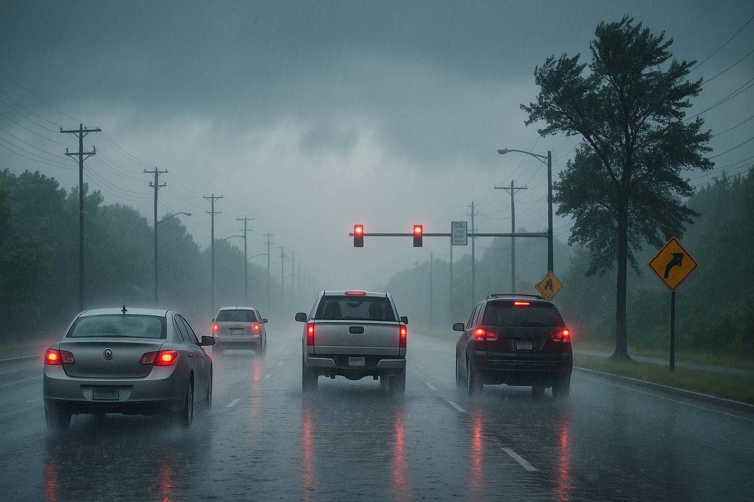
Forecasters say the storm will arrive in two primary waves, both capable of producing intense rainfall. The first round is expected during the early morning hours on Thursday, coinciding with the morning rush. Downpours may reduce visibility and create localized flooding on major roadways, especially in low-lying and poorly drained areas. Weather models indicate rainfall totals between one and three inches, though isolated pockets could receive more if heavier rain bands persist.
The second wave of rain is anticipated for late afternoon into early evening, though the latest models suggest the most severe rainfall could shift earlier in the day. Even with this timing adjustment, officials warn that the ground will likely be saturated by the time the second system passes through, increasing the chance of flash flooding in flood-prone neighborhoods. Motorists are urged to allow extra travel time and avoid driving through standing water.
In addition to the rainfall threat, strong winds are expected to accompany the system. Gusts between 35 and 45 miles per hour could bring down small tree limbs and power lines, leading to isolated outages. Utility crews are on standby, and residents are being encouraged to secure outdoor furniture, decorations, and other loose items ahead of the storm’s arrival.
While the heaviest rain is forecast to taper off by Thursday night, gusty winds will persist into Friday, potentially complicating cleanup efforts and affecting outdoor Halloween events. Fallen branches and power interruptions could continue into the afternoon as the storm system moves offshore but leaves unstable air behind.
Friday’s conditions are expected to be blustery, with temperatures dropping and wind chills making outdoor activities uncomfortable. Trick-or-treaters and parents are advised to check for weather updates and consider alternate indoor plans if conditions remain unsafe. In areas where trees overhang power lines, the risk of falling debris could pose additional hazards for those venturing outside after dark.
Local emergency officials have advised residents to prepare for potential disruptions by keeping flashlights, charged devices, and extra food and water supplies on hand. They also recommend avoiding unnecessary travel during peak storm hours and checking in on neighbors, especially the elderly or those who may need assistance.
By late Friday, conditions are expected to improve gradually as high pressure begins to build behind the departing system. However, forecasters note that lingering gusts could still affect some communities well into the evening. The next several days are expected to remain dry and cooler, providing a brief respite after the storm.
As with all fast-developing weather systems, forecasts could shift as new data arrives. Residents are urged to monitor official updates and heed local advisories. While the storm’s duration will be relatively short, its combination of heavy rain, strong winds, and possible power outages makes preparation essential.
With many planning for Halloween festivities, meteorologists are emphasizing caution. Families are encouraged to have backup plans in case outdoor trick-or-treating becomes too dangerous. Indoor community events, such as school parties or local recreation center gatherings, may provide safer alternatives if conditions remain poor.
Ultimately, Thursday’s storm serves as a reminder of how quickly autumn weather can change in the region. By taking precautions early, residents can minimize risks and ensure that Halloween weekend proceeds safely once the winds subside and skies begin to clear.