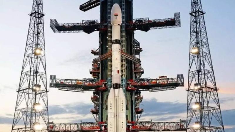
India marked a major milestone in space collaboration today with the successful launch of the NISAR mission, a joint project between ISRO and NASA. Lifted into orbit aboard the GSLV-F16 from Sriharikota, NISAR is set to become the world’s most advanced Earth observation satellite. With a unique dual-frequency Synthetic Aperture Radar that combines NASA’s L-band and ISRO’s S-band systems, the satellite can penetrate clouds, forests, and even darkness to detect subtle shifts in the Earth’s surface, measuring changes as small as a few millimeters.
The $1.5 billion mission sees India investing just ₹788 crore (around $96 million), securing not only a crucial role in its development but also full access to its powerful data. NISAR will orbit the Earth every 97 minutes and map nearly the entire land and ice-covered surface every 12 days. The data will be free and open to researchers, giving India vital tools to monitor glaciers, detect earthquakes, assess land subsidence, and enhance agricultural planning. This strategic investment strengthens India’s disaster response capabilities and boosts its standing in global climate science.
By participating in NISAR, India reinforces its commitment to climate action and gains long-term benefits, including real-time environmental data that can help forecast floods, manage water resources, and study Himalayan glacier melting. The mission represents more than a technological feat it's a step toward sustainability, scientific leadership, and stronger resilience to natural disasters.