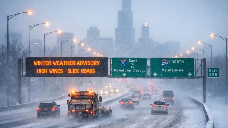
Residents across the Chicago metropolitan area awoke Monday morning to snow-covered roads, sharply colder temperatures and powerful winds following the rapid passage of a cold front through northeast Illinois overnight. Wind gusts climbed as high as 60 miles per hour in some locations, creating hazardous travel conditions and significantly reducing visibility during the morning commute.
Weather officials issued a wind advisory for the entire Chicago area, while a winter weather advisory covered several counties in northern Illinois, northwest Indiana and southeast Wisconsin. Officials warned that slick roadways and blowing snow could create difficult driving conditions, particularly during peak commuting hours. Areas experiencing stronger gusts reported brief whiteout conditions as snow was swept across roadways.
The abrupt return of winter weather followed an unusually volatile stretch of conditions on Sunday, when parts of the region experienced strong to severe thunderstorms, tornado warnings and temperatures that surged into the mid-60s. Storm surveys are expected to take place in the coming days after reports indicated that a tornado may have touched down in Kankakee County, with another confirmed in Iroquois County. Damage assessments are ongoing as crews evaluate the impact of the overnight storms.
By early Monday morning, wind speeds were already strong enough to shake vehicles, particularly on north-south expressways where crosswinds were most pronounced. Traffic reports indicated a challenging commute across the region, with several crashes and spin-outs reported on major highways and ramps. Drive times increased as motorists slowed to navigate snow-packed lanes and gusty conditions.
Traffic cameras throughout the area showed snow clinging to roads and swirling beneath streetlights, underscoring the intensity of the winds. Officials in Lake and McHenry Counties cautioned residents to allow extra travel time and remain alert, noting that conditions could change quickly as snow bands moved through.
Temperatures also plunged dramatically overnight, dropping into the teens by Monday morning. Forecasters noted that the region experienced a temperature drop of nearly 40 degrees within a 12-hour period, marking one of the sharpest declines of the season. Light snow continued to fall in some areas early in the day, though accumulations were expected to remain modest, with up to an inch possible in localized spots.
Snowfall was forecast to taper off by mid-morning, but cold air is expected to linger through the first half of the week. High temperatures are projected to remain in the 20s and low 30s, with even colder readings anticipated as the New Year approaches. Additional chances for snow are possible Tuesday and Wednesday, along with bitter wind chills that could make conditions feel significantly colder than the actual air temperature.
Officials are urging residents to remain cautious on the roads, dress for winter conditions and stay informed as fluctuating weather patterns continue to affect the region.