






















#gulfcoast
Tropical Storm Bertha Gulf Coast Forecast and Warning
Tropical Storm Bertha is moving slowly across the northeastern Gulf, bringing tropical-storm winds, heavy rain, dangerous surf and coastal flooding risks to parts of Florida, Alabama, Mississippi and Louisiana. Residents should follow official updates because the storm’s track and impacts may change. Tropical Storm Bertha forecast The National Hurricane Center said Bertha was located about 11
Tropical Storm Bertha Gulf Coast Forecast and Warning
Tropical Storm Bertha is moving slowly across the northeastern Gulf, bringing tropical-storm winds, heavy rain, dangerous surf and coastal flooding risks to parts of Florida, Alabama, Mississippi and Louisiana. Residents should follow official updates because the storm’s track and impacts may change. Tropical Storm Bertha forecast The National Hurricane Center said Bertha was located about 11
CSU forecasts below-average 2026 Atlantic hurricane season outlook
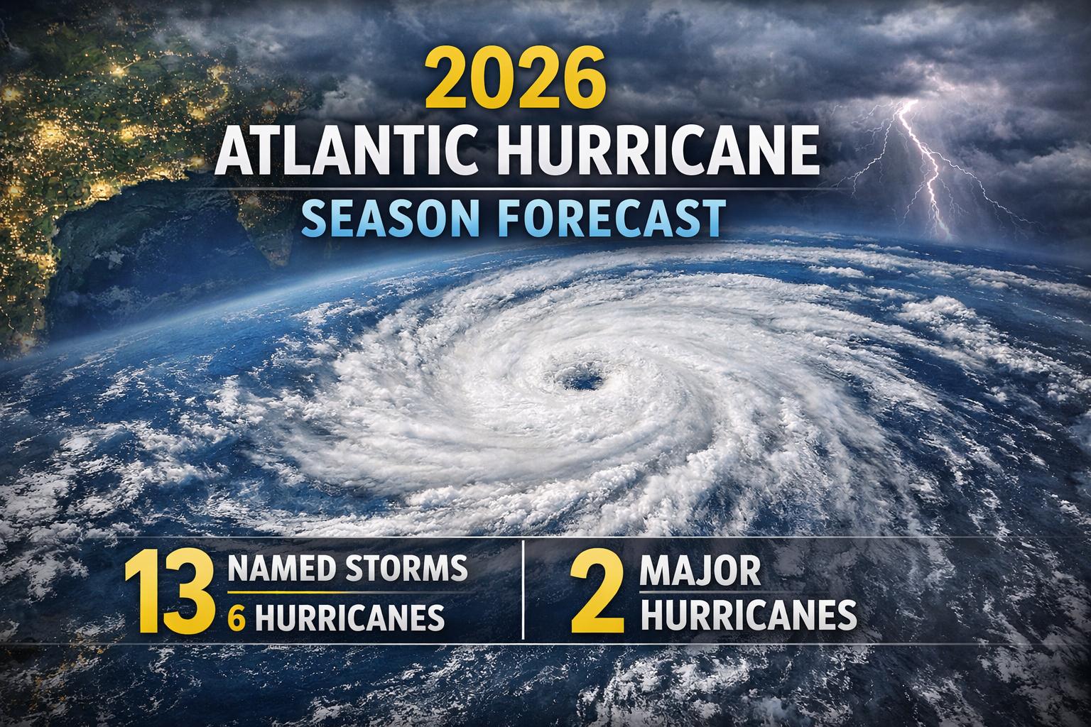
SOUTH PADRE ISLAND, Texas — Thursday, April 10, 2026 — Researchers at Colorado State University (CSU) released their first major outlook for the 2026 Atlantic hurricane season during the National Tropical Weather Conference held on South Padre Island, offering a cautiously optimistic forecast for the months ahead. According to CSU’s Department of Atmospheric Science, the upcoming season is expected to be slightly below average. The forecast projects 13 named storms, including six hurricanes and two major hurricanes classified as Category 3 or higher. By comparison, a typical Atlantic season produces approximately 14 named storms, seven hurricanes, and three major hurricanes. Forecasters attribute the subdued outlook largely to evolving global climate patterns. Current weak La Niña conditions are expected to transition into El Niño in the coming months, a shift that typically increases vertical wind shear across the tropical Atlantic. This atmospheric change can disrupt storm formation and limit the intensity of developing systems. In their analysis, CSU researchers emphasized that El Niño is likely to be the dominant influence during the peak of the season. Increased wind shear associated with this pattern generally reduces the likelihood of strong hurricanes forming and making landfall. As a result, the probability of major hurricane impacts along the continental United States coastline and across the Caribbean is expected to be lower than average. The report also highlights a reduced risk for the Gulf Coast region. CSU estimates a 20% chance of a hurricane making landfall between the Florida Panhandle and Brownsville, Texas, compared to the historical average of 27%. While this suggests a quieter season, researchers caution that even a below-average year can still produce significant and damaging storms. Phil Klotzbach, a senior research scientist at CSU and lead author of the forecast, noted that the projected 2026 season resembles patterns observed in past years such as 2006, 2009, 2015, and 2023. In those seasons, Texas experienced limited tropical activity, with no named storms in 2006 and 2009, and only minor systems recorded in 2015 and 2023. Despite the relatively lower forecast numbers, experts stress that preparedness remains critical, as hurricane activity can be unpredictable and even a single storm can have widespread impacts across coastal communities.
CSU forecasts below-average 2026 Atlantic hurricane season outlook
SOUTH PADRE ISLAND, Texas — Thursday, April 10, 2026 — Researchers at Colorado State University (CSU) released their first major outlook for the 2026 Atlantic hurricane season during the National Tropical Weather Conference held on South Padre Island, offering a cautiously optimistic forecast for the months ahead. According to CSU’s Department of Atmospheric Science, the upcoming season is expected to be slightly below average. The forecast projects 13 named storms, including six hurricanes and two major hurricanes classified as Category 3 or higher. By comparison, a typical Atlantic season produces approximately 14 named storms, seven hurricanes, and three major hurricanes. Forecasters attribute the subdued outlook largely to evolving global climate patterns. Current weak La Niña conditions are expected to transition into El Niño in the coming months, a shift that typically increases vertical wind shear across the tropical Atlantic. This atmospheric change can disrupt storm formation and limit the intensity of developing systems. In their analysis, CSU researchers emphasized that El Niño is likely to be the dominant influence during the peak of the season. Increased wind shear associated with this pattern generally reduces the likelihood of strong hurricanes forming and making landfall. As a result, the probability of major hurricane impacts along the continental United States coastline and across the Caribbean is expected to be lower than average. The report also highlights a reduced risk for the Gulf Coast region. CSU estimates a 20% chance of a hurricane making landfall between the Florida Panhandle and Brownsville, Texas, compared to the historical average of 27%. While this suggests a quieter season, researchers caution that even a below-average year can still produce significant and damaging storms. Phil Klotzbach, a senior research scientist at CSU and lead author of the forecast, noted that the projected 2026 season resembles patterns observed in past years such as 2006, 2009, 2015, and 2023. In those seasons, Texas experienced limited tropical activity, with no named storms in 2006 and 2009, and only minor systems recorded in 2015 and 2023. Despite the relatively lower forecast numbers, experts stress that preparedness remains critical, as hurricane activity can be unpredictable and even a single storm can have widespread impacts across coastal communities.
Houston rain timeline updated: storms peak Saturday into Easter weekend
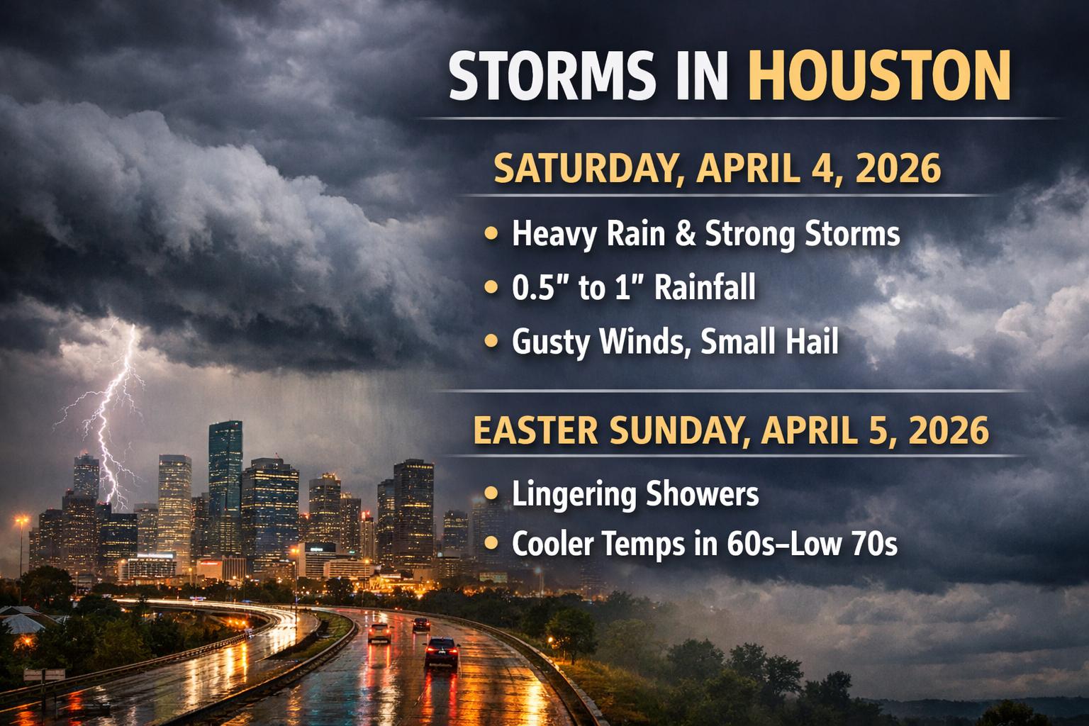
HOUSTON — An updated weather outlook indicates a more active and impactful pattern developing across the Houston area, with the most significant rain and storm activity now expected on Saturday, April 4, 2026, as conditions evolve into the Easter weekend period. Forecast models show a strengthening system moving through Southeast Texas, supported by moisture from the Gulf of Mexico and an approaching cold front. This combination is expected to produce multiple rounds of showers an
Houston rain timeline updated: storms peak Saturday into Easter weekend
HOUSTON — An updated weather outlook indicates a more active and impactful pattern developing across the Houston area, with the most significant rain and storm activity now expected on Saturday, April 4, 2026, as conditions evolve into the Easter weekend period. Forecast models show a strengthening system moving through Southeast Texas, supported by moisture from the Gulf of Mexico and an approaching cold front. This combination is expected to produce multiple rounds of showers an
India seals historic US LPG import contract for 2026 supply
India has signed its first structured, long-term contract to import liquefied petroleum gas from the United States, marking what government officials describe as a major turning point in the country’s energy sourcing strategy. The announcement comes at a time when global energy markets remain highly volatile and nations are increasingly seeking diversified, stable supply lines. According to the Ministry of Petroleum and Natural Gas, the agreement will help safeguard India’s fuel supply du
India seals historic US LPG import contract for 2026 supply
India has signed its first structured, long-term contract to import liquefied petroleum gas from the United States, marking what government officials describe as a major turning point in the country’s energy sourcing strategy. The announcement comes at a time when global energy markets remain highly volatile and nations are increasingly seeking diversified, stable supply lines. According to the Ministry of Petroleum and Natural Gas, the agreement will help safeguard India’s fuel supply du


