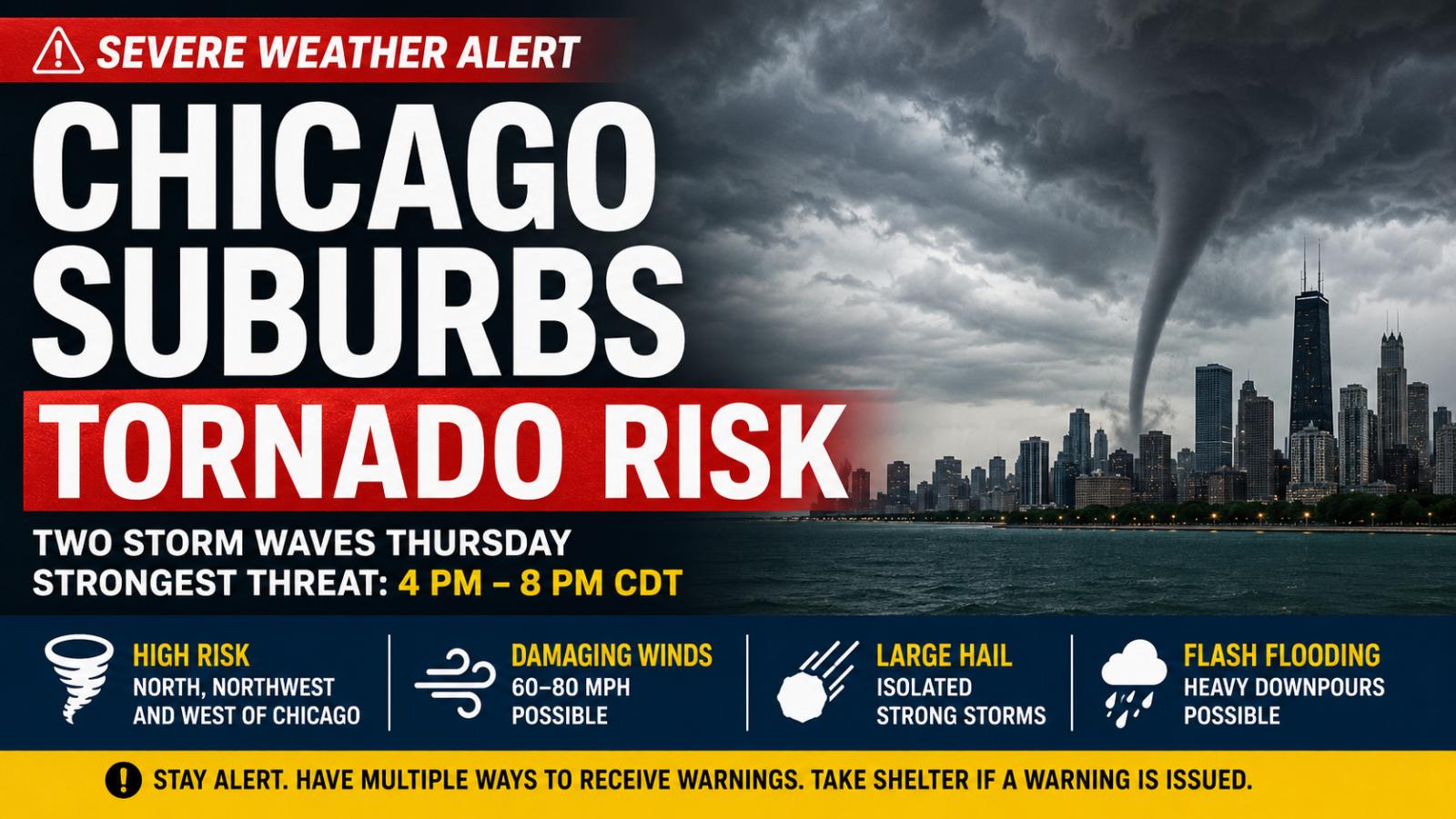
Chicago suburbs tornado risk is rising as forecasters warn of another round of severe storms across northern Illinois on Thursday, June 11, 2026.
The National Weather Service in Chicago said the tornado threat had increased, with two possible waves of storms expected during the day. The most concerning period is expected between 4 PM and 8 PM CDT, especially along and north of I-88.
Chicago Suburbs Tornado Risk Highest North and West of the City
Forecasters said the highest tornado risk is expected in suburbs north, northwest and west of Chicago. The threat depends partly on where a warm front stalls Thursday evening, with the boundary possibly setting up over northern Illinois or southern Wisconsin.
If storms remain discrete, meaning they stay separated rather than merging into a larger line, they could strengthen more quickly. The National Weather Service said that setup could support strong tornadoes, including EF-2 or stronger tornadoes.
An EF-2 tornado can produce winds of 103 to 135 mph and may cause major roof damage, snap or uproot trees, and damage well-built homes.
Two Severe Storm Waves Expected Thursday
The first storm wave is expected between 11 AM and 3 PM CDT, mainly north of I-80, with damaging winds and hail as the primary threats.
A second wave is expected between 4 PM and 11 PM CDT from west to east across the area. That round could bring all severe weather hazards, including tornadoes, damaging winds, large hail and flash flooding.
Damaging wind gusts could reach 60 to 80 mph or higher in stronger storms, according to the National Weather Service.
What Residents Should Do
Residents in the Chicago suburbs and surrounding communities should have multiple ways to receive weather alerts Thursday evening. Officials advise taking tornado warnings seriously and moving quickly to a basement or an interior room away from windows if a warning is issued.
The threat is especially important because the strongest storms may arrive during the late-afternoon and evening commute. Drivers should avoid flooded roads, watch for falling tree limbs and delay unnecessary travel if warnings are active.
The severe weather setup matters because a fast-changing warm front could shift the highest tornado threat within hours, making real-time alerts critical for people across northern Illinois and nearby parts of northwest Indiana.