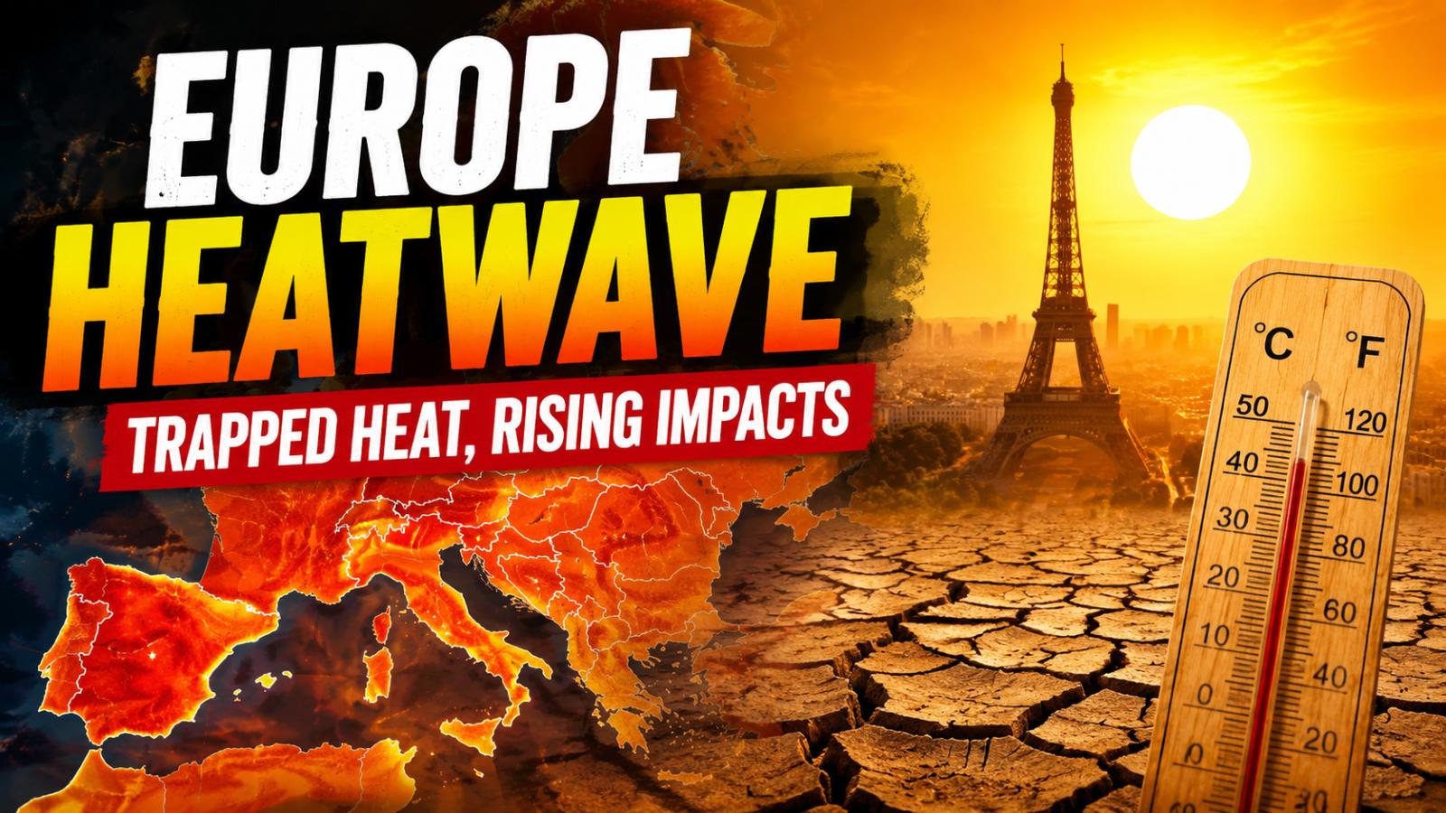
Europe is currently experiencing a severe heatwave driven by a trapped atmospheric system known as an omega block. This Europe omega block heatwave is preventing normal weather movement, locking hot air over large parts of the continent for days. As a result, temperatures are rising sharply, affecting daily life, health systems, and infrastructure across multiple countries.
What is driving this extreme heat
The main reason behind the heat buildup is a stalled jet stream pattern. In this pattern, high pressure sits over Europe in a shape that blocks cooler air from entering. Instead of changing weather systems, the same hot air remains in place and continues to intensify under strong summer sunlight.
This creates repeated days of extreme heat rather than short-term spikes. Nights also remain warm, giving the human body little time to recover from daytime heat exposure.
Countries facing the strongest impact
The heatwave is affecting a wide region including France, Germany, Italy, Spain, Switzerland, the United Kingdom, Poland, Czechia, Hungary, and parts of the Balkans.
Several areas in Central and Eastern Europe have recorded temperatures above 40°C, with some locations reaching historic highs. The heat is spreading gradually eastward as the trapped system shifts across the continent.
Why some regions are more exposed
Southern Europe is directly exposed to hot air moving from North Africa and the Mediterranean. Countries such as Spain, Italy, and France experience intense surface heating due to prolonged sunlight and dry conditions.
In Central and Eastern Europe, countries like Germany, Poland, Czechia, and Hungary face heat accumulation over landlocked regions, where hot air remains trapped for longer periods.
Impact on health and daily life
Health systems are under growing pressure as heat-related illnesses increase. Conditions such as dehydration, heatstroke, and cardiovascular stress are rising, particularly among older adults, outdoor workers, and people without cooling access.
Reports from multiple regions indicate excess deaths above normal levels during the heatwave period, highlighting the seriousness of prolonged exposure to extreme temperatures.
Transport systems are also affected. Railway lines expand under heat, causing delays, while road surfaces soften and become unstable. Energy demand increases as cooling systems are used more widely, putting pressure on national grids.
Agriculture is also suffering due to dry soil conditions, reduced crop yields, and falling river levels. In some regions, water availability is becoming a growing concern for both farming and urban supply.
Public response and risk outlook
Authorities across Europe are advising people to stay hydrated, avoid outdoor activity during peak heat hours, and check on vulnerable individuals.
Hospitals remain alert as heat-related admissions continue to rise. Experts warn that the full impact of this heatwave may take time to appear, as excess mortality data is still being compiled.
The situation highlights how extreme weather patterns are becoming more persistent and widespread, with the omega block heatwave showing how atmospheric conditions can directly affect health, infrastructure, and daily life across Europe.